Home buyers looking for exceptionally good public schools often list Saratoga with Cupertino Schools as an area of interest. We’ve written about some of the neighborhoods there previously, but today we want to talk about this area of the city more broadly.
Where is the part of Saratoga with Cupertino Schools?
Saratoga with Cupertino Schools is found in the northwestern part of the city along the borders of Cupertino and West San Jose. Broadly, the south follows Cox Avenue and the north Prospect Road, but there are plenty of zigs and zags. Adjacent school districts include Saratoga and Moreland (Saratoga has a section in Moreland Schools also).
The areas east of Saratoga Sunnyvale Road are either flat or nearly flat, but to the west of it the terrain becomes hilly. Some homes enjoy amazing views.
Home prices are often very similar to Saratoga with Saratoga Union School District. Buyers may be considering both areas, or any areas with Cupertino schools
Neighborhoods that include this area
Neighborhoods in Saratoga with Cupertino Schools include these which we’ve written about previously:
Blue Hills This area includes a number of subdivsions, including Kirkmont, Sea Gull, Azule Homesites, Meadowbrook (townhomes), Blossom View, Park Saratoga, and more)
Greenbrier (within the larger Blue Hills neighborhood)
The Blue Hills neighborhood in Saratoga is highly regarded for its natural beauty, well designed homes, excellent public schools, parks, and good commute location. From this community it’s a quick jaunt to coffee shops, restaurants, parks, trails, and shopping.
Interested in Blue Hills neighborhood real estate? Scroll to the bottom of this article and you’ll see a list of homes for sale or recently sold in and nearby this corner of Saratoga
Where is the Blue Hills neighborhood?
Click to view larger map on Google My Maps
The Blue Hills neighborhood is found in the northeastern part of Saratoga, close to Cupertino.
Most sources consider the Blue Hills neighborhood to be bordered by Saratoga-Sunnyvale to the west, Prospect Road to the north, Highway 85 to the east, and Cox Avenue and the railroad tracks to the south. Blue Hills Elementary School is found within this area as well. It includes the Greenbrier subdivision and part of the Summerplace subdivision (the other section is north of Hwy 85).
But the boundaries are a little squishy! The Blue Hills School attendance area is much broader, stretching well past Saratoga-Sunnyvale Road and encompassing this whole area of Saratoga with Cupertino schools (part has this school as the default, and Lincoln as an option).
Additionally, there is a subdivision named Blue Hills of Saratoga off of Prospect Road with 69 houses. It’s now artificially separated from the rest of the Blue Hills neighborhood by the freeway, which cut through this area in the late 1980s and early 1990s.
A large portion of the neighborhood includes the Greenbrier subdivision and homeowner’s association. Adjacent residential areas include Prides Crossing (mostly with the same Cupertino schools, but some of it is in the Saratoga Union School District) and the Golden Triangle, among others.
The exquisite Saratoga Oaks neighborhood is nestled between downtown Saratoga and the beautiful coastal foothills, close to the famed Hakone Gardens. With both pools and tennis courts and a location just a block or so from tony Saratoga Village (click to see slide show), it is resort living in Silicon Valley at its finest. But this is not just a place for retirees who want to downsize, though they are also drawn here – families with kids also move to Saratoga Oaks to make use of the top rated schools.
Which public schools serve this neighborhood?
Saratoga Oaks is within the very highly regarded Saratoga Union School District. Although many other school districts in Santa Clara County assign children in homes to particular schools, Saratoga does not – it is an “open” school district. If there’s space and if the home is within the district, you may be able to chose which of the excellent Saratoga schools you wish for your student to attend. The nearest public school is Saratoga Elementary on Oak Street, but you may find enrollment instead at Foothill Elementary or Argonaut. The higher level schools are Redwood Middle School and Saratoga High School. California has transitioned to new school assessment, away from the old 2010 API scores, but you can check the new Saratoga Union School District “Report Cards” here. Additionally, there are two excellent private elementary schools nearby: Sacred Heart (Catholic) and St. Andrew’s (Episcopalian).
Where is Saratoga Oaks?
The Saratoga Oaks community is within the city of Saratoga, California, and is a part of Silicon Valley and what’s locally referred to as “the south bay” area. It can be reached either via Springer Avenue, off of 4th Street in Saratoga or from Springer off of Big Basin Way (aka Hwy 9 or Congress Springs Road). This townhouse complex is literally where the town meets the hills – so it is not at all uncommon to find deer in the open spaces! Click on the map image to go to the live, interactive Google map. (more…)
Saratoga’s Golden Triangle neighborhood is highly sought after for many reasons, including its highly regarded public schools, convenient location, scenic views of the hills, and larger homes and lots. This central Saratoga neighborhood has slightly curving streets, making for a more semi-rural feel.
In this article we’ll go over some of the main draws and what to look for when selling or buying a home in the Golden Triangle.
Golden Triangle street view in the Argonaut area along Regan Lane.
The Golden Triangle is a large, mostly flat portion of Saratoga defined by the 3 major streets bordering this community: Cox Ave to the north, Saratoga-Sunnyvale Road to the west, and Saratoga Avenue to the southeast. These boundaries were defined long before Highway 85 was installed. In recent decades, some websites have turned the triangle into a quadrangle by limiting the northeast side to the 85 boundary, but that is not correct.
In early 2025, the Cal Fire map for risk zones was updated, and the Golden Triangle is out of those fire hazard severity zones. Insurance companies have their own, proprietary maps, but often the two are connected. You can view the new fire map HERE – please note that you can enter an address in the upper left hand corner or you can zoom in again and again.
Looking for a great area in Saratoga to call home? Consider the Argonaut neighborhood, part of the larger Golden Triangle area in Saratoga, which enjoys highly regarded schools, plenty of convenience, and a pretty setting to boot.
Where is the Argonaut neighborhood?
While there are no firm boundaries for this pocket of the city, there are a number of landmarks that make it easy to identify. Argonaut Elementary School is at the heart of the Argonaut neighborhood. Another landmark that locals will remember is the Argonaut Shopping Center. And there are two subdivisions also bearing the name: Argonaut Place (home of Argonaut Drive) and Argonaut Glen.
You can see in the image below that there are also a number of unnamed tracts in the area as well, and those often get included when defining the Argonaut neighborhood.
So generally speaking, the Argonaut neighborhood includes the shopping center, subdivisions, and homes within just a few blocks of Argonaut Elementary School.
The Greenbrier neighborhood in Saratoga is prized for many reasons, including pretty streets with well maintained homes and highly regarded Cupertino schools.
In this post we’re review the location, home types, neighborhood amenities, pros and cons of the area, and also what homes are for sale, under contract, or recently sold there to provide a general sense of the Greenbrier real estate prices.
Where is the Greenbrier neighborhood?
This community is part of the broader Blue Hills neighborhood in Saratoga (Additionally, there is a Blue Hills subdivision which used to be contiguous but now is separated by Highway 85. The boundaries are Prospect Road on the north, Highway 85 on the east, Cox Avenue and the train tracks to the south, and Saratoga-Sunnyvale Road to the west. It’s located just north of the Golden Triangle and is adjacent to Prides Crossing.
Map data: Google, boundaries and overlay by Mary Pope-Handy using Google My Maps
The Bellgrove neighborhood in Saratoga, California, is an attractive, newer subdivision in a convenient location with Saratoga schools. It is highly sought after for all of those reasons.
Bellgrove neighborhood houses
Most homes and yards are very well tended, even pristine. Only a couple looked like they could use a little paint or get their front yards tidied up a little. This community is really quite beautiful. Often when communities look this good it’s because of the HOA’s enforcement and the HOA dues. There’s no Homeowner’s Association (HOA) enforcing aesthetics, it’s just the pride of ownership at work.
What will you find at Bellgrove? Here are some key features in this luxury neighborhood.
Quick facts:
There are 94 homes in this subdivision
The homes were built by Greenbrier in 1996 (date per county records)
All of the houses provide 5 bedrooms
All of them have 3 full bathrooms
All enjoy 3 car garages
All are 2 stories – no single story homes available
There are 3 floorplans, with the smallest offering 2900 SF and the largest 3139 SF
Lots run from 5803 SF to 11,154 SF (the older house, not part of the tract, has just over 18,000 SF)
The neighborhood includes a large greenbelt area, a playground, and a par course up against the freeway
The Bellgrove neighborhood is within the boundaries of highly desired school districts: the Saratoga Union School District (K-8) and the Los Gatos Saratoga Union High School District
Most homes do not have pools – just 11 of the 94 do.
Most homes are owner occupied – only 7 are rented out.
Map data: Google. Neighborhood boundaries and overlay by Clair Handy.
The Portos-Harleigh neighborhood is a highly sought after community in Saratoga. Suburban yet centrally located, walkable, and easy access for commuters. Keep reading to learn more about this neighborhood, its homes, the local amenities, possible concerns, and home costs.
Neighborhood Profile: Boundaries and Property Descriptions
This community encompasses a number of streets north of West Valley College, and is named by its most prominent streets: Portos Drive and Harleigh Drive. It’s major borders are Saratoga Ave to the north west, Fruitvale Ave to the west, and Allendale Ave to the south between Fruitdale and Via Alto Ct.
This community lies within the greater Gardiner Park neighborhood (according to NextDoor), which also includes the Saratoga Gardens subdivision, Aspesi / Casa Blanca, and Riverdale communities to the north, and Peremont tract to the east.
It includes multiple tracts and was primarily built up in the 1960s and 1970s, but there are younger homes as well. Kerwin Ranch Ct and the end of Ronnie Wy are two smaller tracts built up between 1987 – 1995. Throughout the neighborhood there have been individual rebuilds over the years.
Most homes are on large, standard lots, but there are a smattering of flag lots as well.
The Average Portos-Harleigh Home
If I pull the data on homes in this mapped area. Here’s what the “average home” would look like:
The Parker Ranch neighborhood is found in the low western foothills of Saratoga along the Cupertino border, making it a fantastic commute location for many high tech workers. With larger homes and lots, it’s easy to stretch out! The rolling hills make a pleasant vista, or, if you’re in a higher elevation provide beautiful valley views. The Parker Ranch subdivision boasts highly acclaimed Cupertino schools. There are many reasons why this is a much beloved area of Saratoga.
There are just shy of 80 houses and luxury homes in Parker Ranch, so it’s not a hugely populous area, but it is fairly large. Here are a few quick facts on this scenic subdivision:
Range of home size: 2,797-7,500 SF
Average SF: 4,517 SF
Range of lot size: 22,000-146,361 SF
Average Lot: 70,786 SF
Years Built: 1900-2013, lots of development in the 1980s
Side note for history buffs: this land was once owned by “Painless Parker“, the famous – or infamous – dentist. Click on the link to learn more!
What do homes cost in the Parker Ranch area?
Because there’s an incredible variety in home and lot size, as well as age and condition, it’s not easy to pinpoint the likely price of the neighborhood. However, as a very broad rule, most homes will currently sell north of $3.5 million.
What are the subdivision’s boundaries?
Map Boundaries: Streets include Vista Arroyo Ct, Star Ridge Ct, Prospect Rd (pasture only), Picea Ct, Pheasant Ridge Rd, Parker Ranch Rd (major road), Parker Ranch Ct, Farr Ranch Rd (2nd major road), Farr Ranch Ct, Diamond Oaks Ct, Continental Cir, Comer Dr, and Chiquita Ct. To the W and N, the border is Prospect rd. A SW portion borders the Saratoga Country Club. To the S is Mt Eden.
Map data: Bing, neighborhood boundaries by Mary Pope-Handy.
Any special issues with Parker Ranch homes?
As with all homes in or near the coastal foothills, there are special challenges that go with the scenic views and abundant open spaces. Water and drainage will be very important to manage here, controlling the flow of the water away from the home and away from crawl spaces takes more work when there are slopes.
There are high voltage power lines running through part of the community, with some homes built very close to both the lines and the towers.
Part of Parker Ranch may hear train sounds. Some of the area may be in unstable soils zone (landslide areas, common west of Saratoga Sunnyvale Road). Most or perhaps all of it is in the Very High Fire Hazard Severity Zone, which is a higher risk area for fire, but also means the insurance premiums will be much more expensive.
Today we’ll share with you our Saratoga California neighborhood map! Saratoga is home to some stunning neighborhoods and subdivisions and is one of the most sought after areas in Silicon Valley.
Within this pretty city, have you ever wondered what neighborhood is where? Perhaps you’ve heard of Saratoga Oaks, The Golden Triangle, Parker Ranch, Prides Crossing or The Platinum Triangle and had no idea where they were. While there is some disagreement on select boundaries, the general areas can be identified fairly easily. The tricky thing is that some of the boundaries are “messy” and at times, that there’s more than a little overlap!
I have created and been updating Google My Maps where I hand drew in most of the residential areas’ approximate borders for the Saratoga California neighborhood map and this is where you’ll find the detailed list of better known communities, tracts, or subdivisions.. I hope that you find it helpful! Click on the map image below or use this link to see the live map on Google (you will be able to click on an area and see the neighborhood name, and in some cases, a little local information on it too).
Saratoga neighborhoods and subdivisions plotted and described include The Golden Triangle, Blue Hills, Prides Crossing, Fruitvale, Platinum Triangle, Bellgrove, The Vineyards, Saratoga Oaks, Austin Corners, Montewood, Parker Ranch, Les Chateaux de Notre Dame, Squirrel Hollow, Brookview, and several more. We have posts on some of these and are adding to that list periodically, so check the menu bar under neighborhoods and Sartoga to see what we have now.
Schools in Saratoga: a neighborhood note about messy boundaries
Helping nice folks to buy and sell homes in Silicon Valley
Mary Pope-Handy, Realtor ABR, CIPS, CRS, SRES
Christie's International Real Estate Sereno, Los Gatos, CA 95030 408 204-7673 Mary@PopeHandy.com License# 01153805
Clair Handy, Realtor
GREEN
Christie's International Real Estate Sereno 214 Los Gatos-Saratoga Rd Los Gatos, CA 95030 ClairHandy@sereno.com License# 02153633
Mary & Clair sell homes throughout Silicon Valley: Santa Clara County, San Mateo County, and Santa Cruz County. with a special focus on: San Jose, Los Gatos, Saratoga, Campbell, Almaden Valley, Cambrian Park.
The real estate search
Use this link to browse properties which are for sale, under contract (pending) or sold. Want to view only homes which are available now?
Mary Pope-Handy, Realtor ABR, AHWD, CIPS, CRS, SRES Christie's International Real Estate Sereno DRE License #01153805 408-204-7673 mary@popehandy.com “Helping nice folks to buy and sell homes in Silicon Valley since 1993”
Clair Handy, Realtor, GREEN Christie's International Real Estate Sereno DRE License #02153633 408-721-6160 clairhandy@sereno.com “Helping nice folks to buy and sell homes in Silicon Valley”
This is the Valley of Heart's Delight blog , covering Silicon Valley real estate - Santa Clara County, San Jose, Los Gatos, Cupertino, and nearby communities in the South Bay Area and lower Peninsula. Find info on neighborhoods, disclosure issues, buyer and seller tips, and housing market conditions in the west valley and most of the county.Please also see my other websites and real estate market statistics site, which are listed in the sidebar, above.
Sitemap
SanJoseRealEstateLosGatosHomes.com
Mary Pope-Handy, Realtor ABR, CIPS, CRS, SRES Sereno DRE License #01153805 408-204-7673 mary@popehandy.com
“Helping nice folks to buy and sell homes in Silicon Valley since 1993”


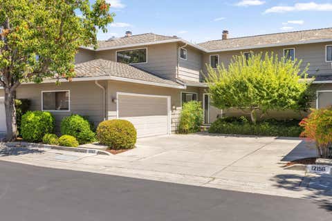
 $1,700,000
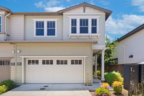
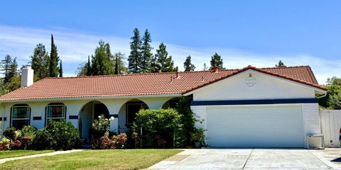
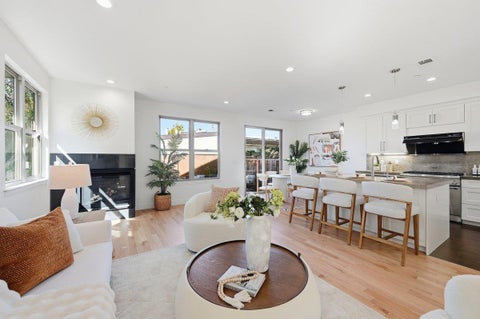
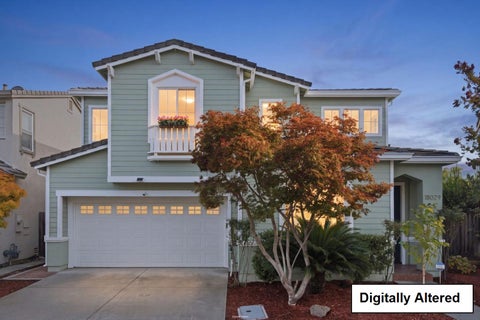


 The Greenbrier neighborhood in Saratoga is prized for many reasons, including pretty streets with well maintained homes and highly regarded Cupertino schools.


